At least once each winter we would take a family trip to Wahnuhke. Most times our method of following the frozen channels was by walking, skiing, horse-drawn sleigh or, when there was almost no snow on the ice, on skates. It was before the days of scoots, snowmobiles or ATVs.
Most of we older members of the family were not good skaters. The exception was June, the eldest child, who when we lived in Ottawa during World War 2 had taken lessons at the renowned Minto Skating Club, of Barbara Ann Scott fame.
June was a natural athlete, especially on skates. I was not, but thought I could become better the harder I tried. Dad created a rink in our backyard for June to practice on, and me to work on my secret dream to skate like the Toronto Maple Leafs.
Years later it became clear that would never happen. Skaters don’t move on their ankles. I did, and always would. I just was not built for skates or most other sports but I loved skating and would do it whenever the chance arose (preferably without an audience).
So when we skated to Wahnuhke one winter, and I had all that ice to whirl around on, regardless of my weak ankles, it was a heaven-sent opportunity to do just that, and the clear ice off the boathouse was the perfect rink — sheltered, smooth, and mostly private.
Elsewhere, my skating was assisted if I had a hockey stick which seemed to help me stay upright. At the island there was no hockey stick, or anyone to see when my skates went out from under and I would slide great distances on my backside. Who cared?
That thought was dashed when around the point another teenage male, a total stranger, suddenly appeared, casually blading along like he was born on skates. His winter boots were slung over his shoulder for when he had to go ashore. Fortunately I wasn’t “on me arse” at that moment. I waved but got no respnse so I guess he wasn’t expecting to run into anyone else either and didn’t see me. Good thing too because that wave upset my balance and down I went.
In my mind’s eye I can still see him — with quite a bit of envy — as he skated along casually but expertly, heading back to Honey Harbour probably thinking only of the girl at Franceville that he had been likely visiting. (One of Wilf France‘s daughters. That was the nearest winter habitation to Wahnuhke.) If he was doing some courting, I’m sure he had a track worn on the ice right past our place and never gave it a glance.
If you supplied ice to cottages back in the 1950s, before electricity reached many islands, what would the cottagers, and you, do if you ran out before the end of a hot summer?
You found some ice PDQ (without delay)!
For the Ojibway’s iceman that fall-back source was Oldfield’s commercial fishery on Range Island, Pointe au Baril. I believe the Oldfields hailed from Meaford.
Now I, a teenager, had been slugging ice and freight in and out of boats for two summers and figured I was in tip-top physical shape. In fact, privately I thought I was pretty hot stuff. I was about to meet my come-uppance.
When I pulled the Iceboat into Oldfield’s dock their boats of course were all out in the Bay hauling and setting their nets. Minding the fishing station was a young Danish man who had been expecting me.
Back at the Ojibway I had my own method of getting the big blocks out of the icehouse, washing them and loading them into the boat. They were heavy, usuaslly between 70 and 100 pounds. At Oldfields, before I could even grab my ice tongs, the Danish chap had washed a 100-pounder, hauled it to the boat and suggested I get aboard and stow it where I wanted it.
He then turned back for the next block and thus didn’t see (I hoped) my pathetic effort to load the first block myself (I was used to having a helper). After almost punching a hole through the boat’s bottom, I maneuvered the block on the aluminum pan where the ice was stored under a tarp. The Dane was waiting with the next block.
Somewhat amused (I thought), he suggested he would lower the block into the boat, and I could take it from there. Which is what we did. The whole procedure was done in minutes and I was on my way
Two days later I was back for more ice. It was a hot day and the Dane was shirtless, exposing the rippling torso of a bodybuilder, which he probably was. No way this skinny teenager could compete with that, I told myself, and we parted amicably, humbling though it was to admit I wasn’t a match for a muscular commercial fisherman.
Oldfields at Pointe au Baril for many years provided refuge to travellers caught in bad weather along the Bay’s east shore. The following link describes more:
The St. Lawrence Seaway was officially opened in 1959 by Queen Elizabeth II and Prince Philip, the Duke of Edinburgh. They came to Canada and proceeded up the new waterway system to the Great Lakes aboard the royal yacht Britannia. Doing so, they demonstrated the purpose of the Seaway in opening the centre of the continent to much larger ships from salt water.
After the formalities, the Britannia carried the royal couple on a tour of the lower and upper Great Lakes, including Georgian Bay. My English father Kenneth With, a retired Royal Canadian Navy officer, and I, a 23-year-old ex-Royal Canadian Sea Cadet with an almost gushing enthusiasm for pomp and ceremony (now greatly diminished, I admit), decided that nothing would stop us from seeing the royal flotilla up close when it came our way.
Here are excerpts from my description of that very memorable moment of 62 years ago:
The royal yacht Britannia on Georgian Bay, as taken from the With “yacht” Blackduck, July 4, 1959.
On July 4, 1959, Her Majesty’s Yacht Britannia, escorted by the frigate HMS Ulster (a World War 2 veteran), and Canadian destroyer escorts HMCS Kootenay and Gatineau (both just commissioned earlier that year), would appear on the horizon west of the Giant’s Tomb Island bound for the old military town of Penetanguishene. From there the Queen and Prince would drive and take a special train to Parry Sound to meet the yacht and escorts again and steam on to Chicago.
It was Queen’s weather (what’s the origin of that old adage?): brilliant sunshine, temperature around 80 F, and just a touch of breeze to ripple the water.
We decided to make for the west shore of the Giant’s Tomb aboard the venerable Blackduck, which had been scrubbed, polished and painted in honour of the occasion. From there we would watch the western horizon for the flotilla.
This shore of the Tomb is very rugged. It is almost completely covered with granite boulders, some as big as a cabin. We anchored over one of these boulder beds and settled down to wait. The sun was too hot and the clear water too inviting however, so some of the crew, plus Guinness the dog, jumped overboard and made for the shore.
It was a beachcomber’s paradise. Huge logs cast adrift from passing rafts many years before, were jammed between the boulders. A section of smashed planking from a green skiff was cast high on the rocks. Wooden fishermen’s floats with fragments of netting were wound around small shrubs. If only we had time to explore further.
But from the lookout perched atop a high boulder came the cry: “Here they come!” We hit the water, dog and all, and clambered back aboard the Blackduck and other boats that had joined us, started engines, weighed anchors, and roared off across the open Bay to the west.
From over the hazy horizon to the north of Hope Island loomed four huge and unfamiliar shapes. Instead of the tugs, barges, passenger ships, and grimy hardworking freighters we were used to seeing, here came four immaculate and graceful ships that, collectively, had been all over the world. Leading them was HMY Britannia, a vessel known the world over.
As we sped towards them, their shapes became recognizable. The unmistakable royal yacht first, then spread out in formation astern were her escorts. Directly behind the yacht was the dark shape of an RCMP patrol boat, presumably responsible for keeping us clear of the flotilla. It would be busy.
About four miles west of the Tomb we, and it seemed every power boat in the area from small outboards to large cruisers, had joined in transforming the flat calm surface of the Bay into a seething mass of waves rolling every-which-way and, on ours at least, giving some faces a noticeably green palour.
In the Blackduck we got to nearly a stone’s throw from Britannia. Almost dream-like we suddenly had a close-up view of this famous ship: Her deep blue shiny sides glistening with reflections of the water surging past the graceful hull, her upper works spotlessly white, her buff funnel towering above us.
We could even see the bobbing white caps of officers on her bridge as they kept watchful eyes on the swarming small craft below. She flew flags that were unfamiliar to non-navy people. At the bow was the Union Jack; on the foremast was the Admiralty flag; on the mainmast flew the famed Royal Standard (showing royalty is aboard); on the mizzenmast was Canada’s Dominion Ensign (predecessor to our maple leaf flag); and at the stern the White Ensign of the Royal Navy, which crews the royal yacht.
We and countless other boats had been rolling along beside the yacht for about two miles when the the escort ships suddenly changed from three abreast to a single line astern. We had been on Britannia‘s port side, just ahead of one of the RCN escorts when it suddenly turned to form into line behind the yacht. The manoeuvre was done with grace and precision, and was repeated by the other two escorts.
The Blackduck had been rolling along in the terrific waves created by ships and small craft alike, and we in her hanging on for dear life as the old girl went surging through the chop with her engine going full out. It was in this situation that someone noticed a figure emerge from a cabin on the upper deck used exclusively by the royal family. It could only be Prince Philip himself. Despite the rolling of our boat, cameras began trying to get the figure in focus and then clicking furiously. He stayed on deck for several minutes, waving at the floating hordes below.
About a mile east of the lighthouse on the southern tip of the Tomb, the old Blackduck began to cough. The tossing and rolling had put extra strain on her steering gear. We found that water had been leaking through the improperly packed rudder post. In turn the engine, working at constant high speed, had splashed rising bilge water onto its ignition system causing the missing. Anticipating a stall, the skipper eased her away from the swarming escort boats and well out of the waves before the engine finally stopped.
It was obvious now that we would not get to Penetang to watch the party disembark in the Royal Barge and land at the town dock.
Our gallant old lady had done her best. With all the “spit and polish” we could give her, the Blackduck had raced across her home waters for several miles, proudly displaying her RCNSA (Royal Canadian Navy Sailing Association) penant on her bow and her Blue Ensign (permitted to RCNSA members, of which Kenneth With was one) at the stern. It had been human error that caused her breakdown. She had nothing to be ashamed of.
Blackduck as she looked in 1959, after 28 years on Georgian Bay.
So we lay, rolling in the last of the swells, watching the flotilla round the buoy for Penetang. A peaceful silence quickly surrounded us. We drifted a half mile or so east of the Giant’s Tomb and passed out sandwiches and beverages. Then we waited for the engine to dry out. While doing so, we were able to watch the less spectacular follow-up events of that day.
After the flotilla had passed, I had noticed a wisp of smoke west of the Tomb. Now as we had our lunch, around the southern tip of the island came a heavily laden freighter of Canada Steamship Lines, likely on her way to unload grain at Midland. She was quite a sight herself. Her crew had “dressed ship” with signal flags for the royal occasion. The flotilla had likely passed her out in the open Bay as she plodded to her destination. A lone fishing tug had preceded her, maybe deciding that this was no day for fishing with the Queen passing by.
Suddenly there was a roar over our heads and, skimming towards us from the north at only a few hundred feet altitude, thundered an RCN Grumman Avenger patrol aircrafft. It scooted over us heading towards Penetang, probably part of the navy’s escort duties.
Then peace settled in again. The engine at last dried out and started, and we were able to pump the bilge. We decided to wait and watch the ships come out of the harbour.
Now we were able to absorb the significance of what we had seen that day. We discussed how this had been a slice of history and we, in a very small way, had been part of it.
Another lake freighter towing a barge, both of the Paterson Line, had been slowly making their way outward bound in the shipping channel. They were almost to the Tomb when the royal flotilla re-appeared.
HMS Ulster and one of the destroyer escorts had sailed into Midland harbour to “show the flag” and turn around, while Britannia disembarked the royals and the other RCN ship stood by. They all met up again at the entrance to Penetang harbour, falling neatly into line as they steamed back out to the open Bay bound for Parry Sound.
Aboard the yacht, the Royal Standard and Admiralty flags had been replaced by another White Ensign and the colours of the ranking admiral.
We were lying a couple of miles north of the channel by then and had an unobstructed view as they headed for the open. It was late afternoon. The sky was free of clouds and the water clear of even a ripple. Spread in line before us, steaming into the lowering sun, was Britannia and her three escorts. Ahead of them was the humble freighter and her tow.
In that order they each disappeared behind the Giant’s Tomb. Our last view of Britannia was a quietly majestic one. For a moment she was alone on the horizon. We could see the water reflecting on her glistening sides, her wake rolling away from the hull. Her tall raking masts with their flags stood out against the paling summer sky. The last we saw of her was those masts moving above the trees of the island.
The silence aboard the Blackduck was broken only by the gentle lapping of water along her sides. Then from far out west of the Tomb came a deep-throated three-long/two-short formal Great Lakes salute from the lowly freighter. I wonder if any flags were dipped as an acknowledgment.
British frigate HMS Ulster.HMCS Kootenay leads flotilla into Toronto harbour.HMCS Gatineau was the other RCN escort.
Most art lovers familiar with Canada’s iconic Group Of Seven might know of their connection with Georgian Bay. Some of their best known works, and those of their contemporary Tom Thomson, depict in their unique individual styles the waves, rocks and pines of the islands.
A big reason for this was that their prominent patron, Toronto opthamologist Dr. James MacCallum, provided opportunities for the artists to experience the Bay. The Group consisted of A.Y. Jackson, Lawren Harris, Arthur Lismer, J.E.H. MacDonald, Fred Varley, Frank Johnston, and Frank Carmichael. When Johnston left the Group he was replaced by A.J. Casson
MacCallum owned property near the Monument Channel, north of Go Home Bay. The doctor was an avid canoe tripper, sailor and explorer of Georgian Bay, cruising to places like Parry Sound, Byng Inlet and French River from his base on the southeast shore. He had a deep attachment to the Bay that seemed to be captured in the works of these artists.
It being the early 1900s when many young painters were struggling economically, the doctor would invite them to his rambling wooden cottage to sketch and paint, which they did gladly.
A.Y. Jackson, a founder of the Group of Seven in 1920, writes in his autobiography A Painter’s Country that he had met the doctor at the Bay in 1913. “Almost by instinct he could find his way in fog and darkness through the intricate channels…Even after his family had scattered, he would go there (to the cottage) alone to tinker with his leaky old boats, and pace his big verandah facing west, which was often lashed by wind and rain.”
One can almost feel MacCallum’s kinship with the place.
After Thomson drowned at Algonquin Park in 1917 MacCallum “…became a kind of patron saint of the Group of Seven,” Jackson wrote. In appreciation of his generosity, the visiting artists decorated their patron’s cottage walls with paintings of local scenery and symbols of the Bay.
Go Home Bay cottagers welcome the supply boat John Lee in this mural painted by J.E.H. MacDonald in the MacCallum cottage, and now in the National Gallery of Canada (from James P. Barry’s GeorgianBay, An Illustrated History).
Former head of the National Gallery of Canada, the late Charles Comfort has credited MacCallum’s enthusiasm and hospitality to the artists with helping them find “expression in the inspiration this region affords.” Several of their major canvases now in the gallery’s collection were from sketches made at the cottage.
Dr. MacCallum died in 1945, and concern arose in the art world about the future of the cottage’s murals. Five years later the property was purchased by Mr. and Mrs. Henry R. Jackman of Toronto who carried on the MacCallum’s tradition of caring for the work of the artists. However, after about a decade the Jackmans began to worry about the security of the murals on their living room walls, and arranged to donate them to the National Gallery in Ottawa.
I was news editor at the Free Press Herald in Midland, the nearest newspaper to the Go Home area, in the Sixties when the Jackmans alerted us that the National Gallery conservators from Ottawa would be at the cottage to remove the panels containing the murals. On a Monday morning with camera and notepad, I hopped in my small boat and made the long trek to the Monument Channel and pulled into the Jackmans’ dock.
The experts from the gallery were already at work using stepladders and flashlights to painstakingly survey the panels and decide how best to remove them. Mr. and Mrs. Jackman watched attentively — and perhaps a bit anxiously — ready to offer any help the conservators might need.
Charles Comfort, writing in Canadian Art, 1951, describes the murals before they were removed:
“There are 19 panels in all, of which MacDonald’s are possibly the finest. Two of these exist on either side of a massive stone fireplace. The left-hand panel celebrates the history of ‘the Bay’ and includes a Huron Indian, a Jesuit preist teaching Christianity to a child, and a figure possibly intended to be (Samuel de)Champlain. The right-hand panel honours local industry, a trapper, a fisherman, and a lumberjack. The head of the lumberjack is reputed to be the only painted portrait of Tom Thomson in existence, which lends to the panel’s considerable national importance. MacDonald’s other contributions are an upriight panel on the north wall which contains sketches of both Jackson and Lismer in a moving local setting, four other panels which are contemplative fragments depicting native trees in varied seasonal garb, and, on the north wall, the supply boat John Lee, (above) tied to a gigantic rock, eagerly attended by local cottagers.
“Lismer’s contributions include panels of bird life, island recreation and, on the south wall, a large composition in gay holiday spirit of a group of vacationers picnicking in the sunny island spaces, delighting in the surrounding beauty. As well as the living rom decorations, Lismer painted a Chinese dragon on the boathouse, celebrating his rather exotiic interest in the Chinese theatre. Though time has almost obliterated it, this oriental rondel continues to fascinate and confound all who pass within sight of it.
“There are three Tom Thompson panels, each a decorative treatment of wood interior foliage in very low tonalities….
“The general effect,” Comfort observed, “is one of colourful airy buoyancy that suggests they were painted for the private satisfaction of Dr. MacCallum, his family, and his friends.”
At the Free Presss Herald we devoted almost a full page to the story with photos.
Our mooring at Outer Fox Islands, French River delta. (Author’s photo)
Georgian Bay’s coasts, communities, people and their history are begging to be explored. For the early part of my life I was able to soak up the southeastern part of the Bay that way. But by mid-life I was getting frustrated at not knowing, first-hand, the rest of what I privately considered my home territory, even though I no longer lived there. It was a large gap in my experience of the Bay.
So, what to do about it? Take the plunge, I decided. Just get out there and see it, if the opportunity arose. Which it did, right around the time I was due for some sort of mid-life crisis.
In July 1991 my brother-in-law Dave and I had both turned 55 and were looking for an appropriate way to mark this modest milestone. A trip around the Bay — or most of it — seemed like a great idea, so that’s what we planned. Dave had done the route with his young son Tom in an earlier year and was familiar with the drill.
Day 1
We packed our gear and a tiny dinghy aboard his elderly Chris Craft Lancer Whitecap, a sturdy fiberglass 23-footer, open with convertible top, sleeper seats and a small cuddy cabin. We would be gone four or five days, following the Inside Passage north from Manitou, west across the north shore to Killarney, south to Lion’s Head on the Bruce Penninsula, then east across the open bay to the Western Islands and on back to Manitou.
We climbed aboard Whitecap. Dave turned on the ignition and starter, expecting to fire up the engine. It wouldn’t catch. Groan…!
When it eventually coughed to life, the motor was running roughly so we put into Sans Souci where Bernard Martin diagnosed the problem as one carburetor barrel flooding. A few careful taps of a hammer solved that problem, we hoped. We decided to continue. The motor growled much more contentedly.
Departing in mid-morning under a sunny sky and pleasant southwest breeze, we passed the Grahams’ place half an hour later. Finding no one home, we pushed on until, when opposite Iron Rock, we felt that, with our anxiety over the engine, we had earned a beer.
We left the main channel then and worked our way past the west end of Jones Light island. Continuing north, we picked up the main channel coming out of Parry Sound. On the western horizon could be seen the lonely shape of Red Rock lighthouse, and Mink Islands beyond.
While running up the inside of Franklin Island the blue sky became grayer and the wind picked up. Just past noon we reached the wreckage of the small Playfair steamer Metamora which had burned there in 1907. The white painted boiler and machinery was now a channel marker where vessels either proceeded into Pointe au Baril station, or turned west to the Ojibway and Pointe au Baril proper, which is where we were heading.
Whitecap‘s fuel was topped up at the Ojibway. The gas boy turned out to be a friend of Tom’s whose family’s cottage was nearby. Dave went to get some items at the dockside store, while I scanned loungers for any familiar faces from 35 years before. None. What was I expecting — that we’d all still look the same?
Departing the Ojibway and heading out into open water past the Pointe proper, the western sky was getting darker and the southwest breeze had risen to a brisk wind.
An hour later found us anchored inland along Alexander Passage for lunch. We put up the convertible top then as the rain began in earnest. Soon after, as many as ten very wet kayakers coming in from the open lake stopped to ask us where they were. They were using only topographic maps rather than marine charts, and couldn’t follow the nautical markers to even guess their location — not a good idea if the traveler is unfamiliar with local waters and landmarks.
The rain became heavier, waves were higher, both pushed by the stronger wind. Buoy-spotting and pilotage required our full attention now. Under these conditions the dangers of Hangdog Reef became very obvious: Outbound markers and inbound ones immediately to the north, all bobbing up and down in choppy waves, can be hard to spot and easily confused, tempting an unwary skipper to cross over when one definitely should not (unless maybe in a kayak). Proceed westward slowly, carefully checking markers on the chart as they appear. Don’t turn east until the last marker in the open lake has been reached.
The rain beat down all the way north from Alexander Passage, often making visibility difficult. The boat’s canvas top had some gaps, but Dave had a wide-brimmed Tilley hat and I a straw fedora which helped keep our vision clear, if not the rest of us dry.
Off Byng Inlet it was especially uncomfortable. As we came in from the open in a lumpy sea heading for Gereaux Light, an outbound sloop, under power only, was pitching straight into it. After we passed very close to each other at the outer marker, she cautiously turned about and followed us, but soon disappeared in a blinding squall astern. Whitecap proved to be an excellent sea-boat that day.
Off Henvey Inlet, nearing the Bay’s northeast corner, still in pelting rain we passed through a large flock of double-crested cormorants, the most I had ever seen of these large black seabirds.
By five o’clock we were filling the gas tank again at Key Harbour Lodge. To get there we passed the remains of the freighter dock where vessels loaded iron ore brought by rail, from 1907 up to 1916. Later, up until 1938 Canadian National Railway used the facility to unload coal for its routes to the north. It was dismantled around 1960.
The rain was easing now and the wind was more southerly. We left Key Harbour and headed west to our overnight mooring on the northeast side of Outer Fox Islands. From here on, the shore is mostly wilderness with only a few fishing lodges and rare cottages. This is the delta of the historic French River. After logging ceased on this shore, development was frozen, and much of the land became French River Provincial Park. As well as the main boat route just offshore, the hydrographers have marked a delightful inner channel that threads its scenic way among the many uninhabited islands of the delta. Outer Fox was one of these groups.
Dave and Tom had camped there on their earlier trip, and Dave was aiming for the same anchorage. Where the inner route went north and the outer west into the open, we sought a narrow local channel that passed right by Outer Fox.
At this stage the rain became another deluge, drastically reducing visibility. We proceded slowly along the narrow local route with Dave trying to spot familiar landmarks. We failed to see the gap leading to our anchorage. Ahead through the murk loomed a square black-and-white channel marker, indicating we were about to re-join the inner route. Dave was having problems with reverse gear, but was able to turn around in the narrow waterway regardless, and we crept our way back.
“Still pelting rain. Brisk south to southeast wind. We found our gap and wound through the reefs to the small anchorage, mooring in the place Dave and Tom had used before,” state my notes from the trip.
The rain had stopped and the south wind was dropping. But with gale warnings for the following day, we decided to move to the opposite shore. Already soaked from a day of rain, Dave dived to free the stuck stern anchor. We finally moored for the night at seven p.m., having traveled an estimated 85 miles since leaving at nine that morning.
Since leaving Pointe au Baril, this was all new territory for me and it was exciting to see at last, despite the bad weather, many of the places I had heard and read about over all the years. I was especially eager to view the wild and historic French River delta, with its numerous uninhabited islands and intricate channels. We were now in the region traversed frequently for centuries by indigenous trading parties, and more recently since the 1600s by European voyageurs and missionaries. This was storied territory.
Day 2
After the trials of yesterday, Dave was looking forward to a decent night’s sleep. Instead, he was soon awakened by an unbearable racket on the other side of the boat. When he identified the source — myself snoring — no amount of poking or prodding would turn it off. I believe he slept under a pillow for the rest of the trip, although we might have agreed that the snorer would sleep with his head towards the stern to widen the gap between us. Memory fails me on this point Dave, so step in and comment below if you recall how, or if, we solved the problem.
After waking to a bright, sunny morning with a brisk west wind, we learned the gale warning had been cancelled. Still, we decided to stay where we were and use the day to dry out, explore the island on foot, and read. By five o’clock the wind had become very strong so we moved to a more protected mooring further along the shore.
Dave went back to row the dinghy around and waved goodbye to a young couple who had arrived by canoe to our first landing site, and now probably welcomed their newfound privacy. The blueberries on the island were superb, not plentiful but big and tasty. I noted hemlocks growing on the islands. Otherwise the flora and fauna were similar to further south.
Before calling it a day, we washed all our dirty dishes.
Day 3
Around 8 a.m. departing Outer Fox for the Bustard Islands offshore, we were met by a stiff 20-knot wind from the west. We left the main inner channel and picked our way through shoal areas to the southwest looking for a red spar at the northeast corner of the Bustards on the outer channell. From there we turned west towards the lighthouses. In those open waters head seas were between one and two meters, so we decided to not fight it and returned to the Bustards for the day to await better conditions.
The main harbour was well occupied by cruisers and yachts, including some from the U.S. We found a mooring half-way down the south arm away from the other boats and a very pleasant location. From there we could walk ashore or row the dinghy to explore the rest of the group.
I rowed down Wicks Channel, almost to where the view opens to the southwest. This was peaceful, uninhabited space, I thought. Then, hidden at the end of one cove was a travel trailer abandoned on the shore. Some eager squatter must have brought it over the ice in winter, then just left it to the elements and vandals. Despoiler!
The American visitors held a regatta in the main harbour, with various age groups paticipating in rowing inflatables around a marked course. Much shouting and, later, a firearm discharged. Good old Yanks.
Dave rowed eastward through shallow bays and northward to a larger bay also poular with cruisers, passing several cottages along the way. The breeze picked up as the afternoon passed, and he had an energetic row back to our mooring.
We walked up to the height of land on Burnt Island, and spread below us was a large shallow bay at the end of a channel winding in from the southwest. The wind was definitely brisk up there. Blueberries were much more plentiful here than on Outer Fox and just as delicious.
At dusk a nearly full moon rose over the pines and other evergreens. The yachts were all quiet. A whitethroated sparrow sang a vesper, then a loon called from an adjacent inlet. What more could one want?
Day 4
Rain had sprinkled overnight. We awoke to a cool and cloudy morning, with a northwest wind of about 10 knots. The forecast was for it to diminish and the sky to clear in the afternoon. We decided to head to Killarney where we would decide to continue our circumnavigation or return the way we had come.
We were underway from the Bustards before eight, along with numerous other craft apparently eager to move onwards. At the three aligned lighthouses marking the route into French River, the sky to the south and east was ominously dark, but we were heading away from that into the long open stretch to Beaverstone Bay and Collins Inlet.
On entering the open, most waves were less than a meter. Boats going both directions fanned out on their courses, comfortably clear of each other. As it turned out, one — Whitecap — fanned out farther than necessary.
The French River main entrance, marked by a red and white spar, was the turning point for the course to pass south of Grondine Rock and begin the entrance to Beaverstone. We chose our compass bearing to Grondine, roughly estimating deviation caused by on-board effects, and settled back for the long run.
It was my first experience being totally dependent on a compass course without any aid of landmarks. The wind was trending north and we noticed that other boats were closer to shore than ourselves. We put our trust in our chosen course, but began watching for Grondine to the north. We never did see it from offshore but, after about half an hour, Dave decided it was too early for open water cruising and wisely (actually providentially) turned towards land.
In a few minutes we spotted some markers and identified our location off the entrance to Beaverstone Bay. To the east and away inland from our previous course was the big beacon at Grondine Rock silhouetted against a grey backdrop. Hmm. Think I mis-estimated that deviation a bit.
The eastern passage into Beaverstone to Collins Inlet is bounded on the mainland by part of Wikwemikong First Nation and to the west by the large Philip Edward Island. Beaverstone itself has a number of island cottages and seems to be a preferred anchorage for sailing yachts,
The channel narrows and turns west into Mill Lake. On the mainland are the remains of the Collins Inlet logging operation, now partly occupied by a fishing lodge. Across from that on the island side of the lake are several small islands with cottages. Here, the shore of Philip Edward appears to be mostly cliffs or high ground with few landing places.
Ten o’clock found us half way down the west arm of Collins Inlet. It was dull with frequent showers. These conditions gave the impressive cliffs an appearance similar to views of the BC coast. We passed a nice wooden ketch from Sarnia and a palatial Detroit motoryacht Lady Val.
We were off Red Rock Point, or Killarney lighthouse, half an hour later and slowly entered the crowded harbour. Despite Killarney’s popularity, the old fishing village still had its charm. We were able to fuel-up again, do a bit of shopping, and Dave was able to telephone home. We had decided to continue our circumnavigation.
Just about at noon we departed east from Killarney. As if confirming that we had made the right decision, the weather gradually cleared. After passing Red Rock light again, we turned south and set a course of 190-195 for Club Island.
It was now a beautiful summer’s day with excellent long-range visibility. As we were opposite the north end of Squaw Island, Cape Smith on Manitoulin Island appeared ahead to the west, with Rabbit Island showing beyond. A few sailing yachts with the wind astern were heading on the same course as ours.
At 1.40 p.m. we were opposite the north end of Rabbit Island to the west. Away to the east and, as if living up to its name, Lonely Island which is quite high was easily visible lying by itself in the open Bay. Club Island, much lower in profile, was directly ahead.
Skipper Dave takes a break with a cool oneat Club Island harbour. (Author’s photo)
Fifteen minutes later we swung through the narrow entrance to Club Island harbour, joining two U.S. and one Canadian sloops. We anchored near another powerboat just offshore from a ruined storehouse.
The shoreline inside of the harbour entrance had been dredged and a pile of diggings lay on the protective spit. The roof of another building was visible among the low trees on the south shore. I rowed the dinghy in that direction looking for a wreck said to be there — easy to find as someone had marked it with an anchored juice bottle. It apparently is an unidentified metal-sheathed hull 57 feet long.
We had a leisurely lunch under a sunny blue sky, then around 3.30 p.m. departed Club for the first of our two major open water stretches.
It was perfect weather for being on the open Bay. Sunny and clear, a bit of breeze for refreshment and smallish waves. We set a course direct from Club to Cabot Head on the northeast tip of the Bruce Peninsula, a run of about 40 kms/25 mi. In less than 15 minutes we could see the beacon on Halfmoon Island ahead, and much of the northern shoreline of the Bruce.
Half an hour later we were opposite Halfmoon Island, a low gravelly patch of land with dense but scrubby vegetation. The light beacon was on a tower rising above the trees. We passed along the east shore.
Dave estimated we should reach Wingfield Basin in an hour. The view in that time was spectacular as we watched the heights of the Bruce rise on the horizon ahead. In a bit less than an hour, the anchor was down and the engine off in Wingfield Basin, after a marvelous run across from Club Island.
There were 23 other boats moored in the harbour below the Cabot Head lighthouse when we arrived. There was a stone cottage beside the entrance of Wingfield Basin, and the wreck of the barge Gargantua, abandoned there in 1952, is just off the dock, although it was mostly obscured by moored yachts. There was very little activity among the boats at that hour. Around bedtime, a beautiful full moon rose over the trees to the east.
Day 5
By dawn the number of boats in the harbour had increased to 30 or 33, including a couple of very late arrivals, one of which was an OPP (police) cruiser. A man in an adjacent sloop took his small dog ashore in a dinghy to do its business. He carried it in a special lifejacket with handles so it could be picked up like a suitcase.
At least two boats had left the basin already. We breakfasted and washed dishes, I making the mistake of emptying the dishwater overboard and hearing deserved admonishment from the closest boat. One keelboat had moored too close to the east shore and had to be hauled free by the OPP, which then departed along with many others.
The wind was about 10 knots from the northwest. We added all our spare fuel to the tank, planning to refill at Lion’s Head. Weather radio reception was very poor, probably caused by effects of the Niagara Escarpment running along the peninsula. We upped anchor and left Wingfield a little after 10 a.m.
Half an hour later we passed Cape Chin as we ran south along the east shore of the Bruce. The OPP came out of Dyer Bay as we passed and proceded on a parallel course,
At 11.15 we were at Lion’s Head and gassing up again (169 litres). The forecast was for northwest wind possibly reaching 20 knots, which would mean an almost following sea as we crossed to the east shore of the Bay.
After some lunch and a final dishwashing, at 12.20 p.m. we left Lion’s Head, stopping well offshore to discreetly empty the dishwater. Until we were well out from the Bruce the seas were steep (about a metre) and uncomfortable. In the open there was more distance between the waves and Whitecap handled them perfectly without having to be throttled back.
About an hour out, we passed Surprise Shoal. It lived up to its name for us. From a distance we thought the marker was another of several sailing yachts coming south towards Owen Sound. Suddenly we recognized it as a green buoy, and it had to be Suirprise, although we thought it had passed unseen to the north earlier.
Over the next couple of hours the wind and waves increased, but the boat continued to handle it well. As it had risen in view the day before, the escarpment on the Bruce now gradually receded. Cape Croker could be seen easily well to the south. On that clear day we could still view vestiges of land away to the south after it had disappeared in the west, probably the high land behind Meaford and Thornbury. We began to watch the southeast for signs of the Western Islands, expecting to be heading somewhere to the north of them.
For awhile in mid-afternoon on the open Bay, there wasn’t a bit of land to be seen. Then the Westerns lighthouse was sighted to the southeast, farther off our course than anticipated. We altered our bearing from 90 to 120 degrees to intercept the northern islands.
At 3.45 the eastern mainland became visible to the northeast as we approached the Westerns through very steep seas. Ten minutes later, like running rapids we plunge through the gap in the northern group and head for shelter behind the main wooded island.
We came through this gap in the Westerns after crossing the Bay. (Authoor’s photo)
We motored slowly around in circles in the lee for several minutes to give Dave a pause after the long run across the open Bay. Despite the wind and waves, there were people walking on the next island south, apparently having come out from the east shore in a sailing catamaran.
Over the last leg of our voyage between the Westerns and Manitou, about six or seven miles, the waves became even steeper as the depths became shallower, making for the roughest water of the entire trip.
At 4.45 p.m. we arrived back at Pinkham Point, with Barb coming out to greet us in the outboard. It was good to be home. but the exhilaration of that last hour for me will be hard to beat.
The trip rounded out my experience on the waters of Georgian Bay, reinforcing my respect and affection for what some call the Sixth Great Lake.
Alan Howard, a friendly and loquatious marine enthusiast of Toronto, knew all about the Canadian Pacific white fleet that steamed weekly between Port McNicoll and the Lakehead. In the early Sixties, he and other steam buffs had taken the trip on the almost-twins Keewatin and Assiniboia, as they correctly guessed that the service would soon cease and the ships be retired.
SS Assiniboia, Keewatin’s almost identical sister ship.(Author’s collection)
On these trips Alan would tape record the steam whistles of passing vessels as well as the CP twins themselves. By 1964 he had quite a collection and thought there would be historic value in producing an LP recording of them. He visualized the album cover being a colour photo of Keewatin‘s white steam blasting against a background of black coal smoke from her stack, under a bright blue autumn sky.
Knowing I was living in Midland and was a fellow ship watcher and photographer, he asked if I wanted to do a trip with him and try for the cover photo. Would I? Do fish swim? Mind you, I would have to pay my own way, but such opportunities don’t pop up often so a bit of debt would be worth it.
Our trip would be in October, near the close of CP’s shipping season. We boarded the Kee at Port McNicoll around mid-day. Discovering we were the only passengers for the up-bound trip, we settled down for a leisurely crossing of Georgian Bay. Alan knew the pulse of the ship, where we could go without getting in the way and when we should avoid being a nuisance. He had learned that years earlier when he was general manager of the Lake Ontario passenger steamer Cayuga.
Alan Howard, left, chats with Capt. Alex Campbell on the bridge wing.
On previous trips Alan had persuaded Capt. Alex Campbell and Chief Engineer Gordon Gervais to allow him almost unlimited accesss to the wheelhouse and engine room. As we steamed past Giant’s Tomb and then Hope Islands, we contented ourselves with exploring the main decks, meeting the crew and enjoying a magnificent dinner in the wood panelled dining room, with views of dusk settling across the gently ruffled surface of Georgian Bay. It was like stepping back in time to an era of elegant lake travel from the 1920s and before, with Keewatin as our private yacht.
I didn’t want to climb into my berth that night. After dark I wanted to experience the open lake and watch the lighthouses pass by. Until then they simply had been names on the chart, but now I could actually see them across the dark waters for myself.
We awoke next morning to the sound of ship’s whistles all around us. Grabbing the tape recorder, we hustled up to the bridge as the ship crept through thick fog on the St. Mary’s River. Although marine radio was mandatory on Lakers by then, fog signals were also required (and still are) particularly in congested waterways.
As booming whistles and blaring horns bounced through the murk around us, Alan was ecstatic, his microphone aimed at every signal he could catch. Eventually the fog lifted and we passed through the Sault Ste. Marie locks just after breakfast.
With the captain’s permission, we decided the bridge outside the wheelhouse was the best place from which to record and photograph. Equally important to us, however, it was a chance to simply hang out with the crew. Alan could spend hours sharing stories and experiences especially with people aboard ship, and as a listener I soaked it all up.
On Keewatin he had a competitor. Chief Engineer Gervais, with a twinkle in his eye and a finely tuned sense of humour, could almost match Alan story for story. When he was off duty, the Chief would climb to the bridge to see how our project was coming along and have a good chat. The two of them together kept the men in the wheelhouse entertained.
Chief Engineer Gordon Gervais visits the bridge.
The Chief was from Victoria Harbour, next door to Port McNicoll, and his wife was the local correspondent for the Free Press so I would see him from time to time in the years that followed. When the Kee retired I believe he did too. With his pipe in his teeth, his cap at a jaunty angle and a grin on his face, the Chief epitomized the real steamship man of that era.
Much less garrulous was Capt. Campbell. Though always polite and easy going, the Scottish born skipper wasn’t comfortable chatting up passengers, unlike his counterpart Capt. Ernest Ridd of the Assiniboia who apparently greatly enjoyed being host at his ship’s Captain’s Table.
Clearing Whitefish Bay, past the Sault, Keewatin turned her bow northwest across the vast expanse of Lake Superior. The sun beamed upon us from perfectly blue skies, the wind was brisk but not unbearable from the open lake where the ship traffic fanned out in different directions, and eventually we had our part of the inland sea to ourselves.
In the wheelhouse: wheelsman, mate, deckhand.
Hour after hour in that magnificent autumn weather we steamed along. Activity on the upper deck slowed to a regular routine. It was a good time to try and get our cover shot.
Alan’s vision of Keewatin‘s stack belching black coal smoke and white whistle steam against a backdrop of blue sky and water would never be more achieveable than that afternoon. We alerted the Chief to get lots of thick smoke ready. Then, stationing ourselves behind the wheelhouse, we would signal the officer inside to pull the whistle cord and I would snap away.
I was using a borrowed Rolleiflex camera with colour slide film as we were serious about getting quality images from which colour separations for printing could be made easily when the time came. As the sun moved around to the southwest to light that side of the ship, we spent the better part of the afternoon snapping that picture.
We finally called a halt to the photography. I’m sure everyone aboard sighed with relief as whistle-free silence descended. All that could be heard was the wind in the rigging and the waves breaking along the ship’s sides.
This view, in colour, was to be the cover of the steam whistle album.
After another fine dinner and bedtime snack later, we turned in and awoke next morning tied up beside a warehouse in Fort William. Alan and I rented a car and spent the day exploring the Lakehead waterfront, returning to the ship next morning.
She was still being loaded with bagged freight on pallets, and this time several passengers with cars came aboard. The Kee was no longer our private yacht.
With so few passengers, the steward’s crew began closing the ship’s cabins. Bedding and linens were removed for winter storage. Cabins were thoroughly cleaned, and things generally were shut down for another season.
As we came down the Sault locks, Capt. Campbell revealed his seamanship skill by turning the ship 180 degrees in the busy and fast-flowing St. Mary’s River, to face upstream so we could stop briefly on the Canadian side to let passengers off. A boom was swung out and an agile young crewman Wayne Garrett was swung out and down to the dock to take the ship’s lines.
Our last evening was spent cruising down the river. The radio told us a freighter had grounded in Detour Passage. As we passed, there was just enough daylight to see the ship in the distance. Before turning in that night I went out on deck to see if the light on Great Duck Island was visible. Frank and Juanita Rourke of Midland were lightkeepers there then. Juanita’s column Up The Shore was a popular feature in the Free Press for years.
I’m sure it was The Ducks light I saw so I gave it a silent salute. A nice conclusion to a memorable experience I will never be able to repeat.
A sad ending to this story is that Alan Howard’s whistle project never came about. As curator of Toronto’s marine museum, he had saved a number of steam whistles there and would blow them for visitors, much muted, using a reversed vacuum cleaner. The city moved and then closed the museum, and the artifacts have been in storage ever since. Meanwhile, Alan passed away and eventually his widow did too, and all the material for the recording disappeared.
Wouldn’t it be good if it was found, and someone as keen as Alan Howard completed the project? I can only hope…
Footnote – This was Keewatin’s second last year on that run. At the age of 58 she and Assiniboia were too old to meet modern safety standards. Assiniboia eventually was sold to become a union’s shoreside training vessel but sadly she burned at Camden, New Jersey, before that could happen and she was scrapped. Keewatin was luckier. She was towed to Holland, Michigan, where she became a marine museum and was carefully preserved. In 2012 she was returned to Port McNicoll where for ten years she was meticulously maintained by Friends of Keewatin until 2023 when she was donated to the Maritime Museum of the Great Lakes at Kingston, ON, for permanent display.
Alan Howard, in wheelchair, with Marine Historical Society of Detroit members on Keewatin’s final trip to Fort William in 1965. Below: she steams out of Port McNicoll for the last time.(Author’s photos)
You may have read the post below about The Iceman. This one is different. It’s about what not to do when dealing with ice on the Bay in the very early spring.
It was April in the mid-Sixties and I was living in Midland on the south shore of the Bay. Every year at that time certain people get restless and fight an urge to get out on the water and poke among the islands. I was (and still would be if not “retired”) one of them. But even though rain, wind and rising temperatures had been pushing ice from the channels, it was a slow process.
Some men over Honey Harbour way had flat-bottomed welded steel outboard boats they could use to fight the hard, loose honeycomb ice. I had a boat but it was a cedar strip outboard, not an ice fighter. My good friend had a tough little fiberglass outboard boat. I was able to persuade him that she could get us out on the water.
Saturday morning dawned sunny and calm. We launched his boat at Honey Harbour and set out up the main channel, which was mostly clear of ice, and the skipper opened the throttle. We skimmed over the flat surface towards Bone Island where his relatives had a cottage. As we passed entrances to several side channels I noticed they were still choked with hard honeycombed ice but didn’t give that another thought. Our route was clear almost to the end. As we approached the cottage, we had to stop and push aside a few floating ice pans to reach the dock.
By now the sun was smiling down upon the islands and we climbed the high rocks behind the cottage to absorb the view. There wasn’t another human within sight or sound.
Time slipped by as we explored the woods and shorline like a pair of little boys playing hookie from school. In early afternoon the faintest wisp of wind could be felt but we paid it no heed. Eventually our rambling took us back to the dock where the boat — our tiny ticket to the outside world — was moored. Gradually we realized that the zephyr we had felt earlier had become a brisk breeze and the peaceful shore had become filled with sound.
Hard, sharp and musical. Honeycombed ice off Wahnhuhke.
It was a gentle but massive tinkling, like a thousand glockenspeils sounding at once. The source soon became obvious. The wind was blowing bits of ice together towards the dock where our boat was tied. If it went on much longer we would be stuck there. And no one knew where we were! We had to get out, and fast.
The ice was a semi-solid mass by the time we got the engine started and the boat away from the dock. We had about thirty meters of it ahead of us before reaching open water.
My friend gently put the boat’s bow into the crystals, and I took an oar and pushed at them with all my strength to clear a path for our escape. Soon we were completely surrounded. Leaving the motor on “slow ahead”, the skipper tied the tiller and grabbed the other oar. Together we pushed our way through the mass with the motor providing forward thrust.
The hard chunks scraped along the boat’s sides. Straining and grunting, we fought the ice like a mortal enemy. We each wondered how the fiberglass hull was withstanding the gouging without being punctured. The sweat of our efforts became mixed with that of fear.
It seemed to take forever to reach open water. By then the afternoon was late and we still had miles to go. Keeping a sharp eye out for floating chunks in the low chop that was now riffling the water, we sped along in the fading daylight back to the mainland.
As we hauled the boat onto its trailer at the marina, we examined the hull. It was scarred at the waterline but not punctured, and for that we were grateful. But our carelessness had shocked us.
We had unwittingly taken some foolish risks: No one knew where we were. We failed to foresee that the loose ice moves with the wind. We did not watch closely how the wind rose in the afternoon. We were lucky we had oars, strength, a tough little boat, and a dependable motor to get ourselves out of trouble.
The moral? Don’t let enthusiasm trump safety. Plan ahead.
By the time the big launch had crept through the growing darkness past Eshpabekong Island, waves pushed by a strong east wind began to make it roll. Giving a wide berth to a shoal at the north end of Giant’s Tomb Island, the skipper ran south along the boulder beds of the Tomb’s west shore. Picking his spot carefully, he eased the boat’s bow up to the rocks. Two youths with flashlights jumped ashore and disappeared into the woods. The boat backed away and dropped anchor in deeper water. We settled down to wait.
As night fell completely on that windy, rainy September evening, we who were left on the boat chatted occasionally but, being three groups of strangers, eventually ran out of conversation. We strained our eyes seeking a light on the shore, indicating that the boys had found the American campers marooned on the other side of the island, and had led them through the dark woods to the boat.
Many acts by “heroes” go unrecognized because they are done quietly, out of compassion and goodwill, with no thought of getting anything in return. In this case it was the Robitaille families of Cognashene. On that blustery evening about 60 years ago, they rose to the call to help those young campers, at no small risk to their boat and themselves.
I was by myself at Wahnuhke that afternoon when a small boat from Tomahawk Island to the south landed on the west shore. Two anxious looking fellows about my own age came to the door. They explained that four or five of their friends had gone to the Giant’s Tomb’s eastern beaches for an overnight camp-out and had not returned.
A glance outside explained why. The easterly wind had been blowing all day, creating good sized surf on the beach and lowering the water level like an ebbing tide, making it impossible for the campers to launch their boats. I was asked if we could take the Blackduck to go out and rescue them.
A dilemma! I estimated that the boat’s gas supply would not get us all the way to the Tomb and back, and there was nowhere open to buy more. And with the east wind a rescue would have to take place from the west shore, which meant wending our way in dwindling daylight through the unfamiliar waters, finding the campers and lead them back through the woods to the boat in the dark.
This was a serious situation requiring more skill and experience than I had. But we had to do something. The young teens who included a couple of girls were probably badly frightened, out of food, their boats useless in the heavy surf. I emptied every drop of gas I could find into Blackduck‘s tank and calculated we could at least get to Cognashene and back. We got extra flashlights and raingear, and headed west.
We pulled into the dock at the R.Y. Eaton cottage and explained our plight to the caretaker. He urged us to contact the Robitailles in Cognashene Lake and took one of our boys in his boat to ask for help.
It didn’t take much persuading. It seemed in no time the Robitaille’s husky launch appeared through the dusk to take us aboard and head for the Giant’s Tomb. I was hugely relieved to put our mission in their capable hands.
I didn’t know the Robitailles personally, but the brothers Celest and Phil were part of a family that had lived year-round at Cognashene since the early 1930s. Like almost all permanent residendts, they had intimate knowledge of the local waters.
To this day, I can still remember marvelling at their ability to steer the boat in the dark among the lurking reefs between Townsend and Eshpabekong Islands, then correctly estimating where on the west side their boys should be landed to cross the island and find the campers.
It was now totally dark as we waited in the boat for a light on shore. Privately, I wondered if they were having trouble, first struggling through the dense woods, then retracing their steps with the campers. At last a light was spotted in the woods opposite the boat. With unerring instinct, or perhaps smart trailblazing, they had come out exactly where they should have.
Everyone was soon aboard the boat again and it was heading through the darkness to Cognashene. The campers were unhurt but were shaken by their ordeal.
They had pulled their boats up on the beach when they landed at the Tomb, but overnight the waves from the east had washed over the sterns, soaking the motors and half filling the boats with water. The tents had blown down, clothing and food was soaked and a campfire was out of the question. They were truly marooned, and the only people who knew their predicament were their two older friends back at Tomahawk who had neither the resources nor know-how to rescue them.
As we boarded our boat back at the Eaton’s dock, we said heart-felt thank-yous and goodbyes to the Robitailles and headed southeast to Tomahawk. The next weekend I was invited to a barbecue at their cottage as a gesture of thanks. I hope they also showed appreciation to the Robitailles because they were the deserving ones. They had rallied without hesitation. Of such stuff are unsung heroes made.
Today, anglers venture into the open waters between the eastern shore of Georgian Bay and the Western Islands in search of salmon. Up to the 1930s, however, these waters were said to be the place where the mighty lake trout began its autumn migration from the depths to their traditional inner spawning waters.
Fishermen and guides of the day would seek word of catches outside of Moose Deer Point in late October and early November, then head out to troll deeply with copper wire line off the Pine Islands, Watchers, and Giant’s Tomb for the most prized catch of the season. Alas, by the early 1950s native lake trout had been almost wiped out by the predatory sea lamprey and probably commercial over-fishing.
When they first got to know each other at Minnicognashene Island, former guide Frank Rourke would tantalize Kenneth With by recounting tales of trout fishing near the Westerns. Dad took those stories seriously but was never able to share the experience. For years hanging in hope on the wall of his boathouse was a special short fishing rod and reel loaded with copper wire, to be used only for lake trout, should the chance arise.
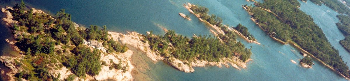
Some of the granite islands in eastern Georgian Bay have sand beaches, mostly small, which make ideal swimming areas especially for children. But for real beachcombing the large outer islands — Christian, Hope, Beckwith and the Giant’s Tomb — are ideal. These are just over the geographic line separating the sandy soil and deciduous woodlands from the rocky pine-clad pre-Cambrian Shield islands extending northward and easterly.
Giant’s Tomb Island with its three miles of almost entirely sand beach along its east shore, was the closest of these big ones to us at Wahnuhke. As children, a picnic or fishing trip to the Tomb was reason for excitement. As teenagers, that enthusiasm didn’t diminish. A summer picnic to that island’s beach was a popular outing
In August, 1957, a group of us including my cousin Betsy and our friend Marion McLeod (see A hidden Birdland) were beachcombing in the shallows near the south end of the Giant’s Tomb. We weren’t actually looking for hidden treasure, but suddenly Betsy’s foot struck something hard in the underwater sand.
As I recall, there weren’t many loose rocks along that stretch of beach so it was unlikely that’s what Betsy’s toe was stubbed by. This required a closer look, so we bent down and started clearing sand from the area. Eventually this revealed a long piece of thick metal. We dug further and found a large metal ring attached to the first piece. An anchor! A large anchor. We dug further until a fluke appeared in the yellow sand.
We were excited now about this find, and kept digging until we could get numerous hands around the shank and gradually pull the anchor out. We held it up and Marion took this picture:
That anchor sat beside the big granite fireplace in the Hegnauer cottage on the south end of Wahnuhke for more than 30 years until the property was sold. It now rests in Marion’s cottage across the channel.
The east shore of the Giant’s Tomb is sheltered from the open Bay where winds from the west prevail. From the mid-19th Century to the early 20th, the channel passing the island was heavily used by sailing vessels and steamers of all sizes. When westerlies picked up and waves grew higher, probably skippers of the smaller of these took shelter behind the Tomb.
Betsy’s anchor may have been from one of them. Why it was lost and left there is a mystery. The anchor line broke? It was hurriedly cut when something threatened the vessel? It was found in very shallow water, so maybe it was rowed closer to shore for better holding?
We will never know, so the mystery of Betsy’s anchor continues.
Footnote: A large part of the Giant’s Tomb today is included in Awenda Provincial Park on the adjacent mainland. Parts of the north end are a nature preserve of the Georgian Bay Land Trust.